All places › Rossel (Yela)
Pambwa No.1 (south coast)
Anchorage · Rossel (Yela) · Louisiade Archipelago, Papua New Guinea
Open Pambwa No.1 (south coast) in the interactive mapThe guide
- Position
- 11°24.02'S 154°00.57'E
- Depth
- 9 m
- Wind shelter
- very good in SE
- Shelter
- Very calm in 25 kn SE.
- Getting in
- Via Gwa Passage (route above from outside the lagoon). Easy to see; a wide dog-leg channel (port then starboard) with well-defined reef either side. A good arrival anchorage from Australia.
- Bottom
- mud
- Holding
- good
Our sketch map
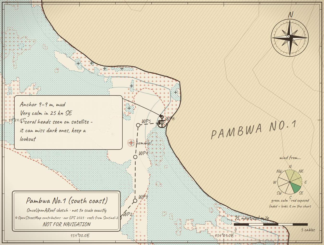
Drawn by us from OpenStreetMap, Sentinel-2 and our GPS. Not for navigation.
More in the Rossel (Yela)
Rossel Lagoon routeTryon BayWol PassageMbuo (Buwo) BayYonga Bay (Pua Bay)Jinjo Mission (north coast)Rossel west - river anchorageRossel north coast mangrove bay - possible cyclone refugeRossel south inlet - possible cyclone refuge
⛵ Sail with us
This guide is free for everyone, sailor or not: explore the islands and watch our episodes right where they were filmed. The two of us made it from our own visits, footage and a lot of late nights over the maps.
▶ Subscribe to OnceUponAReefFollow along for free on Patreon, or become a member from A$3 a month for exclusive videos, each season's update first and meet-ups. Some memberships include the chance to come sailing with us.
♥ Join us on PatreonOpen the interactive mapSources: compendium p109 (Maranatha 2011)
Thanks to Soggy Paws PNG Compendium, Maranatha guide: their notes are summarised in our own words.
This guide is a set of personal cruising notes shared in good faith. Information can be out of date or wrong, and positions can be out by hundreds of metres. It is not a substitute for official charts and notices, your own eyes, local knowledge, or professional medical, legal or customs advice. You use it at your own risk: the skipper alone is responsible for the safety of the vessel and everyone on board, and the authors accept no liability for any loss, injury or damage arising from its use.