Hoba Bay, Pana Numara
Highlights
- Snorkel the western point of Hoba Bay at the right tide - red fan corals, reef sharks, strong current
- Trolling west of the anchorage
- Cray or ray fishing with locals in the lagoon to the west
Stories from our visits
Tracey, the Sunday-school teacher, paddled out with a polite written request for stationery. By the third invitation we went to church, where kids carried our kayak up the beach and every person shook our hands afterwards (5 Nov 2023).
Women of the CRC church cooked for a fundraiser to build a stronger church: K10 a plate, K2.50 for children, nearly K300 raised (Nov 2023).
The guide
- Position
- 11°09.24'S 152°46.75'E
- Depth
- 4–18 m
- Wind shelter
- very good in S
- Our visit
- 4-6 Nov 2023 (diary). Sunday service in an open-sided traditional church with guitars and harmony singing; three churches in the village (United, CRC and another). The Sunday-school teacher asked visiting yachts for stationery.
- Shelter
- Very little roll; well protected from 20-25 kn S-SE.
- Bottom
- very hard sand with coral heads - make sure the anchor is set
- Ashore
- No village at the anchorage - people come round from the village on the point. Basket weaving, grass skirts and clay pots demonstrated for visitors; Uniting church; good vegetables. Walk around Leiga Island at low tide (heron nests, live cowries) or across the island past the copra smoke-house.
- Water
- Washing water only; rain tank may spare drinking water after rain (1992).
- Ashore (us)
- Kids carried our kayak up the beach. Sunday service is in an old open-sided church with guitars and lovely harmony singing, and everyone shakes your hand on the way out (Nov 2023). Three denominations in a small village; the women were raising money for a new church (K10 each, K2.50 a child). A carver gave us a seahorse inlaid with nautilus shell.
Our sketch map
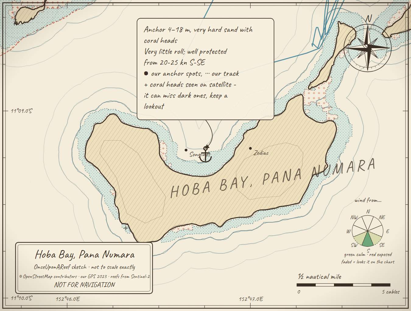
Drawn by us from OpenStreetMap, Sentinel-2 and our GPS. Not for navigation.
More in the Central Calvados
⛵ Sail with us
This guide is free for everyone, sailor or not: explore the islands and watch our episodes right where they were filmed. The two of us made it from our own visits, footage and a lot of late nights over the maps.
▶ Subscribe to OnceUponAReefFollow along for free on Patreon, or become a member from A$3 a month for exclusive videos, each season's update first and meet-ups. Some memberships include the chance to come sailing with us.
♥ Join us on PatreonOpen the interactive mapThanks to Soggy Paws PNG Compendium, Maranatha guide: their notes are summarised in our own words.
This guide is a set of personal cruising notes shared in good faith. Information can be out of date or wrong, and positions can be out by hundreds of metres. It is not a substitute for official charts and notices, your own eyes, local knowledge, or professional medical, legal or customs advice. You use it at your own risk: the skipper alone is responsible for the safety of the vessel and everyone on board, and the authors accept no liability for any loss, injury or damage arising from its use.