Bagaman NW bay - Chief Noah's village
Highlights
- Snorkelling close in with a resident dugong (us, 2023)
- Very quiet - few yachts come here
Stories from our visits
Chief Noah told us how, as a boy on Moturina, people found a dugong stranded at low tide. He could still describe how sweet the meat was. As we talked, a dugong surfaced off the beach - they don't eat them here any more - and Ryan swam with it, his first ever (29 Oct 2023).
Noah looked like he could cry when we said we were leaving. We'd have stayed longer in this peaceful little village.
The guide
- Position
- 11°07.89'S 152°40.33'E
- Depth
- 5 m
- Wind shelter
- good in NE, E, SE
- Our visit
- 28-29 Oct 2023 (diary; the 'Motorina & Bagaman' episode). Patrick met us on the beach at sunset; we swam with the dugong next morning, then moved round to the carvers' bay (Oisi).
- Shelter
- Good in 15-20 kn NE-SE with a slight swell; uncomfortable over 20 kn.
- Bottom
- sand and coral
- Ashore
- "Very quiet village who barely ever get yachties visiting." Lots of pigs on the beach. Plenty of crayfish (older reports). The carvers live round in the NE bay (Oisi).
- Anchoring (us)
- A deep spot: we had a rough night with gusts from every direction and current ripping through the channel on full-moon springs (Oct 2023).
- Ashore (us)
- A quiet, kind village (Patrick and Chief Noah). A dugong feeds off the beach; they don't hunt it any more, and we swam with it.
- People
- Chief Noah and his nephew Patrick - really lovely (us, 2023)
Our sketch map
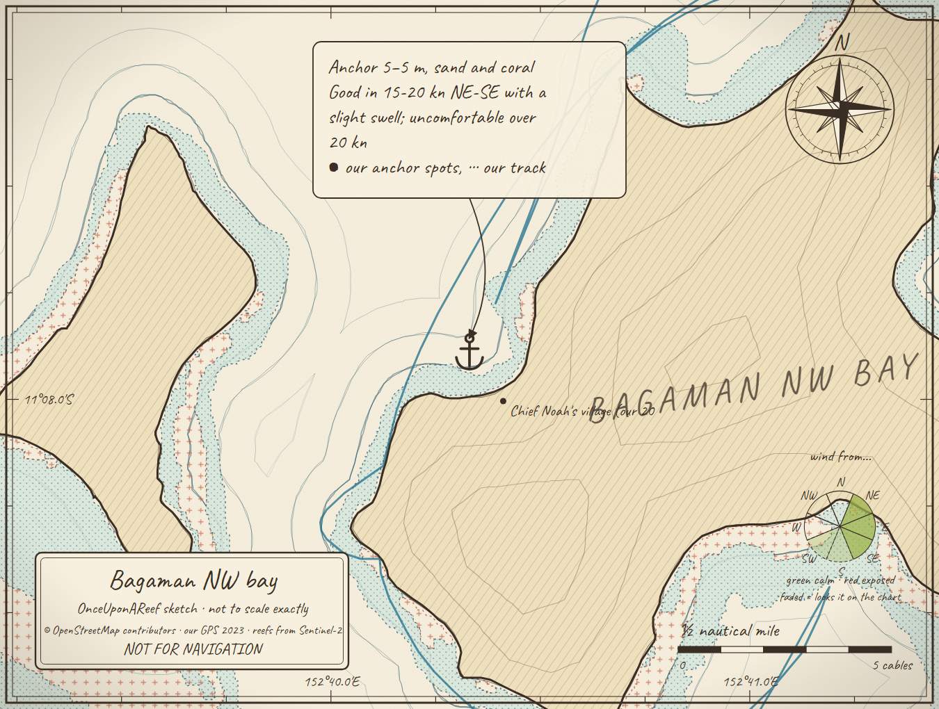
Drawn by us from OpenStreetMap, Sentinel-2 and our GPS. Not for navigation.
More in the Central Calvados
⛵ Sail with us
This guide is free for everyone, sailor or not: explore the islands and watch our episodes right where they were filmed. The two of us made it from our own visits, footage and a lot of late nights over the maps.
▶ Subscribe to OnceUponAReefFollow along for free on Patreon, or become a member from A$3 a month for exclusive videos, each season's update first and meet-ups. Some memberships include the chance to come sailing with us.
♥ Join us on PatreonOpen the interactive mapThis guide is a set of personal cruising notes shared in good faith. Information can be out of date or wrong, and positions can be out by hundreds of metres. It is not a substitute for official charts and notices, your own eyes, local knowledge, or professional medical, legal or customs advice. You use it at your own risk: the skipper alone is responsible for the safety of the vessel and everyone on board, and the authors accept no liability for any loss, injury or damage arising from its use.